
Navigate with Clarity.Decide with Confidence.
Offline maps, real-time slope analysis, route planning, and comprehensive terrain data in one powerful toolkit for your backcountry adventures.
Available on iPhone, iPad, and Android.
Trip Hub
* Elevation and location coordinates have been modified and may differ from actual app display.
Plan beyond the route.
AviAlert 2.0 brings mountain conditions and trip planning together in one redesigned experience.
Explore avalanche forecasts, check mountain weather and turn the information into a plan built around your route, your team and the decisions that matter.
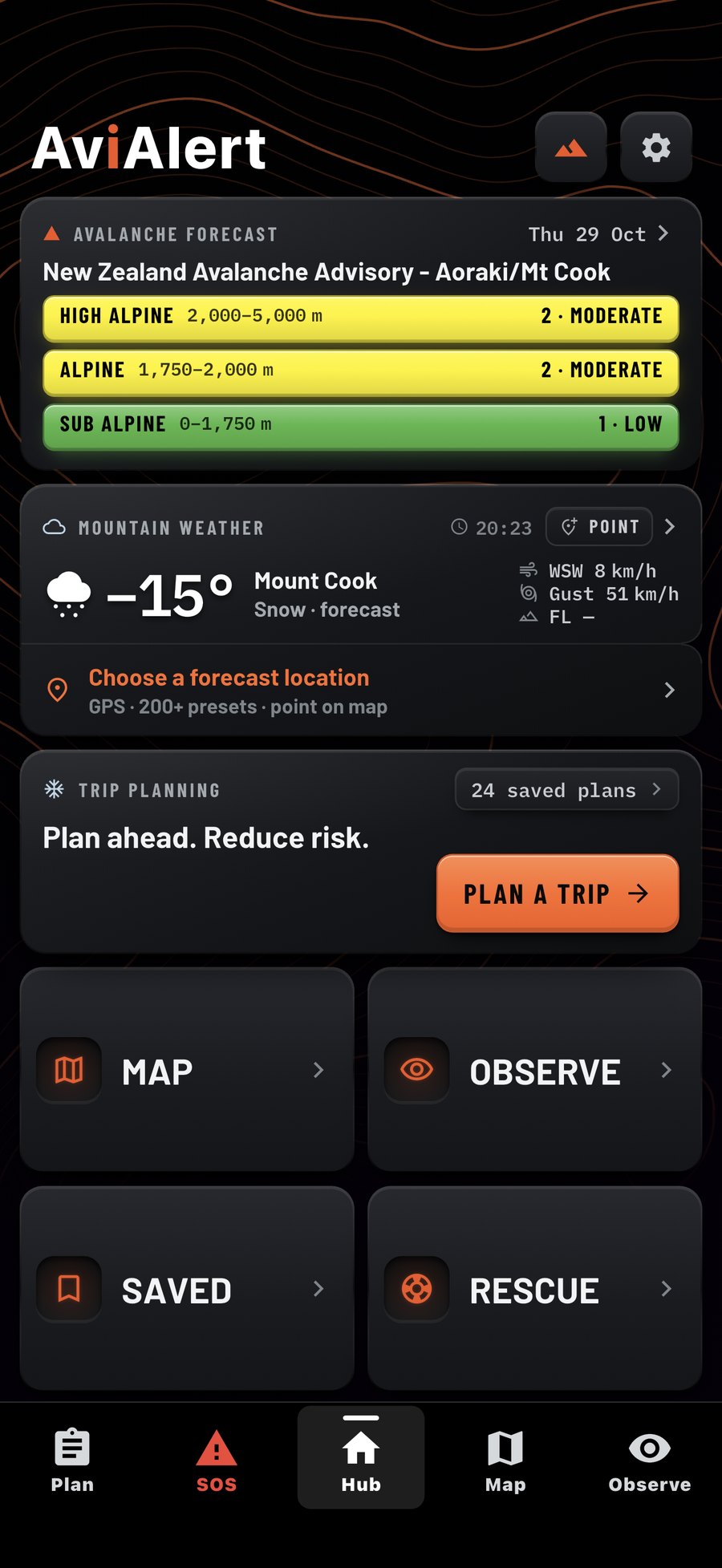
First look at the redesigned AviAlert 2.0 Hub.
Introducing AviAlert Trip Plan
Six questions, one plan for the day. A new way to prepare, discuss conditions and make decisions together.
Mountain Weather, rebuilt
Explore forecasts for your location or mountain destinations, choose forecast models and compare changing conditions.
Detailed Winter Planner, refined
A clearer planning experience, from hazard and mindset through route, equipment, team and sharing.
Core Workflow
Plan, Navigate, and Observe with one decision support system.
Plan
Our step-by-step planning wizard helps you gather forecasts, draw your route, and estimate trip time. Save plans to your library and share with your group.
- Step-by-step planning wizard
- Precision route drawing
- AviPace time estimates
Navigate
Move confidently in the field with offline maps, GPS tracking, and real-time position data. Works without cell service.
- Offline maps
- GPS tracking
- Custom waypoints
Observe
Log observations and conditions during your tour. Build a personal database of terrain knowledge over time.
- AviRecon
- Observation tools
- Continuous assessment
EVERY SEASON.EVERY ADVENTURE.
The Ultimate Touring Companion
Coordinate & Rescue
Pro Planning and Observations
Alpine Trails
Backcountry Sledding
Remote Operations
Explore Waterways
Integrated Toolkit
Everything You Need
In One Toolkit.
AviAlert combines the essential tools for backcountry planning and navigation into a single, powerful application designed to work where you need it most.
Offline Maps
Download detailed terrain maps for offline use.
Rescue Flashcards
Quick-reference guides for high-pressure rescue scenarios.
GPS Tracking
High-precision location tracking in the field.
User Reporting
Log and share field observations with your team.
Terrain Capture
Save photos with slope angle, heading, elevation, and GPS.
Point Forecast
Custom weather forecasts plus 200+ preset backcountry locations.
* Illustrative mock-up. Background image and on-screen values are for demonstration only.